
NAPGD2022
The North American-Pacific Geopotential Datum of 2022 (NAPGD2022) will serve as the future geopotential datum within the National Spatial Reference System (NSRS). It covers three regions: the North American–Pacific region, Guam and Commonwealth of Northern Mariana Islands, and American Samoa. This datum contains all of the necessary information to provide mutually consistent orthometric heights, geoid undulations, gravity anomalies, deflections of the vertical and other geodetic coordinates related to the gravity field.
Users of this page can download, access, and visualize the datum and individual components using the navigation menu.
The major components of NAPGD2022 along with a brief description of each product are provided below.
-
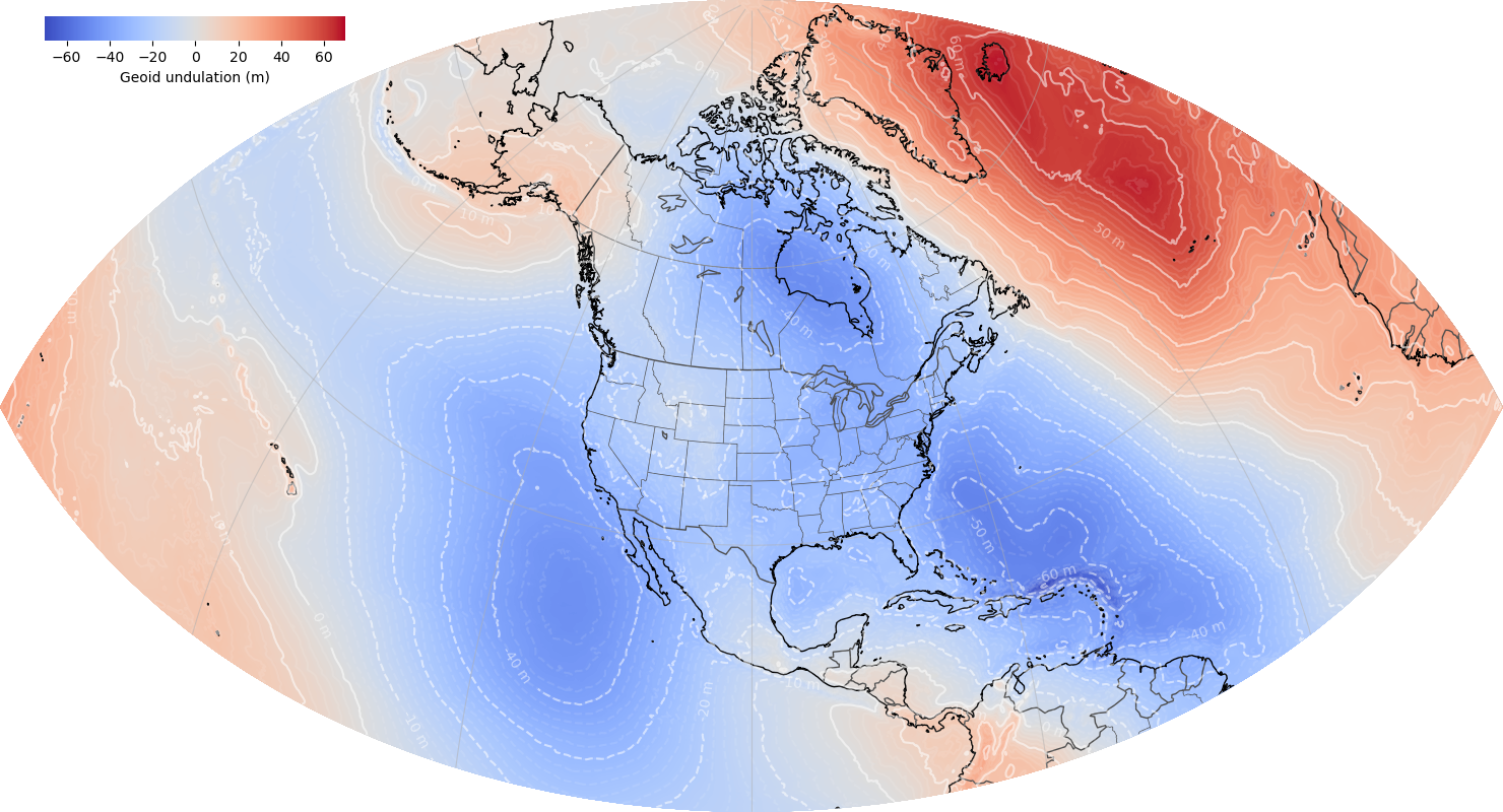
GEOID2022

GEOID2022 provides the connection between ellipsoid heights determined with GPS and orthometric heights used for most applications. The spatial resolution of the geoid model is 1 arcminute. The geoid heights, which are in the tide-free system, are with respect to the reference ellipsoid of the Geodetic Reference System 1980 (GRS80) in the ITRF2020 geometric reference frame. GEOID2022 includes static and dynamic components for the geoid heights related to the gravity field.
-
DEFLEC2022
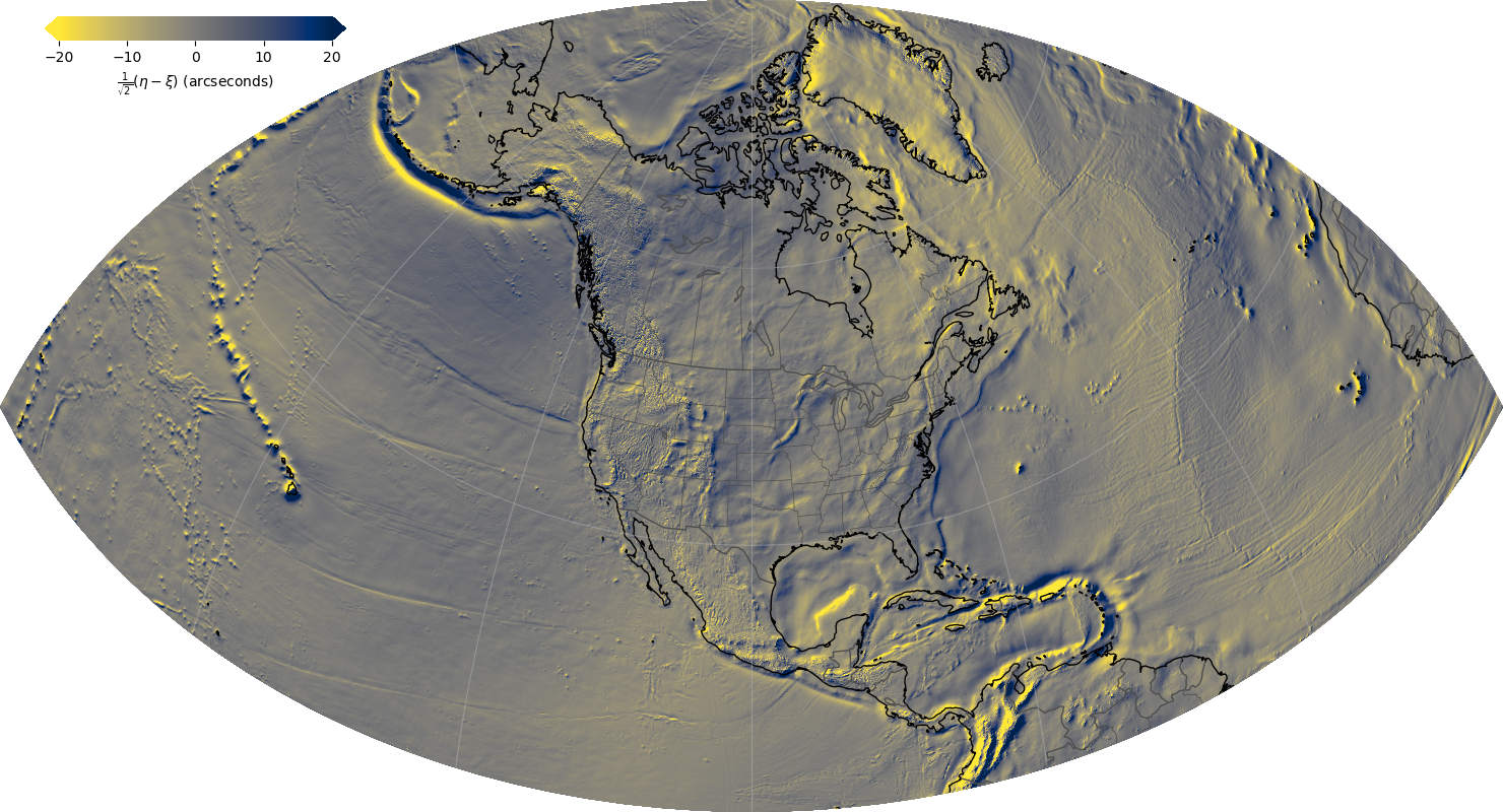
DEFLEC2022 is a companion product derived from the GEOID2022 geoid model, and represents the deflections of the vertical (DoV) at the surface of the Earth. The deflection of the vertical is the departure of a plumb bob's actual pointing from the ellipsoidal normal direction. Deflections are used to relate the orientation of local survey or navigational data to a global spatial reference system.
-
GRAV2022
GRAV2022 provides the surface gravity value at a user’s specified location. It is based on the same datasets as those used in GEOID2022. The surface gravity is provided as a full field gravity value and can be used in geodetic leveling corrections, dynamic height determination, and other applications.
-
GM2022
GM2022 is a global geopotential model that enables users to compute gravity, geopotential, deflections of the vertical, gravity gradients, and other aspects of the gravity field at any location above Earth’s surface. It is provided as a time-dependent set of spherical harmonic coefficients to degree and order 2190, or an equivalent spatial resolution of 5 arcminutes.